|
Helen
Dawe Collection -- Index
Series
6
Aerial
Photographs (6.1)
Bog,
Marsh Sechelt (6.2)
General, Panoramic
views (6.3)
General, Panoramic
views (6.4)
Identified
buildings (6.5)
First Nations
of Sechelt (6.6)
Individual
people/groups (6.7)
May Days, picnics,
etc. (6.8)
Resource Industries
(6.9)
Schools (6.10)
Ships
(6.11)
Transportation
(6.12)
Whitaker
family (6.13)
Cook,
Dawe, Steele, Whittaker familes (6.14)
Series
2
General
A-Z -- The Crucils
Series
10
Union
Steamship and All Red Line Companies
Series
11
Captain
Sam and Ada Dawe
Series
13
The
Sechelt Inn
Series
20
Souvenir
brochures, postcards
Series
24
Merry
Island lighthouse
|
Series
6.2 -- Bog, Marsh Sechelt
The
early photographs depict the Sechelt bog area where present-day Sechelt
is located; the later show the present day marsh wildfowl nature reserve
area to the north-west of the village close to the south-west side
of Porpoise Bay.
1
2 3
 |
6.2.1
1904
-- Sechelt's waterfront and cranberry bog behind Herbert Whitaker's
hotel (center right in photo). Note ginger bread trim on verandah
of Indian's home bottom left. Photograph/negative by Philip T.
Timms. Donor L.S. Jackson
|
 |
6.2.2
circa
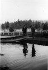
1929 -- Sechelt Bog behind Union Store and west of Wharf Road.
Union Estates cottages in background. Bert Hackett (right) superintendent
of USS Ltd. and postmaster, Harry Billingsley (left) clerk in
Union store. Bog filled up each winter. Photograph courtesy The
Peninsula Times newspaper and the Alsgard family
|
 |
6.2.3
1978
--Last remaining portion of Sechelt Bog, south of Cowrie Street
and west of Trail Avenue. Peat is stacked
west of Dick Clayton's Shop-Easy store. Peat was dug to a depth
of 14 ft. to allow gravel to be spread for the construction of
Teredo Street. Photograph courtesy The Peninsula Times newspaper
and the Alsgard family
|
next>
Copyright
© The Sechelt Community Archives
|

